New Delhi: A recent United Nations initiative on improving the accuracy of world maps has triggered renewed discussion over geography, historical representation and national sovereignty. India has supported efforts aimed at promoting more scientifically accurate representations of the relative sizes of continents and countries, while maintaining that any depiction of its territory must conform to its official position.
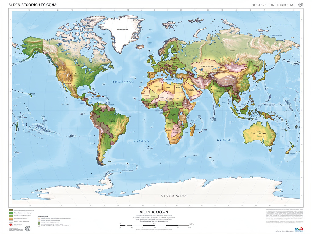
The debate centres on the longstanding limitations of conventional world maps, particularly the Mercator projection, which was developed in the 16th century primarily to assist maritime navigation. While the projection preserves directions effectively, it significantly distorts the apparent size of landmasses as they move towards the poles.

As a result, Greenland, Europe and North America can appear substantially larger on conventional maps than their actual land areas, while regions closer to the equator, including Africa and parts of South America and South Asia, may appear comparatively smaller.
Geographers have for decades argued that equal-area projections can provide a more accurate representation of the relative size of countries and continents, particularly for education, statistical analysis, environmental studies and resource comparisons.
African Countries Push for More Accurate Representation
African nations have played an important role in promoting the use of maps that better reflect the continent’s actual size. Africa is the world’s second-largest continent by land area, yet its representation on commonly used projections can create a misleading impression of its scale compared with Europe and North America.
Advocates of equal-area mapping argue that cartographic distortions can influence how people perceive the geographical importance and scale of different regions. A more accurate representation, they contend, could help students and the wider public develop a better understanding of global geography.
India’s support for such efforts has also been viewed in the broader context of its engagement with countries of the Global South and its advocacy for greater balance and fairness in international institutions.
Geography and Sovereignty Are Two Different Issues
A key distinction in the debate is between geographical accuracy and political cartography.
Geographical mapping deals with the scientific representation of land area, distances and the relative size of continents. Political maps, on the other hand, depict international boundaries, territorial claims and areas that may be subject to disputes.
The mapping initiative discussed in the supplied account concerns the former. It should not automatically be interpreted as a decision altering international borders or determining the sovereignty of disputed territories.
For India, the issue of how Jammu and Kashmir and Ladakh are depicted remains a matter of national sovereignty. New Delhi has consistently maintained that the country’s entire territory, including the Union Territories of Jammu and Kashmir and Ladakh, must be represented in accordance with India’s official position.
India has also maintained that any depiction of its territory that contradicts its official map is unacceptable.

No Automatic Change to the Official World Map
The discussion surrounding the UN initiative has also prompted clarification about what such a mapping decision actually means. A move towards greater use of equal-area projections does not mean that a single new world map automatically becomes legally binding on every country.
Different map projections serve different purposes. Mercator projections continue to have applications in navigation, while equal-area projections are particularly useful for comparing the actual size of countries, continents and ecological regions.
Similarly, the adoption or promotion of a different cartographic projection does not, by itself, change international borders, territorial claims or the legal status of disputed regions.
Significance for Education and Research
The wider adoption of scientifically accurate maps could have important implications for education and research. Schools, universities and research institutions could use equal-area maps to provide students with a clearer understanding of the actual proportions of the world’s landmasses.
Such maps could also prove useful in fields including climate research, biodiversity studies, population analysis, agricultural planning and the assessment of global resources.
Digital mapping technology has further expanded the possibilities for presenting geographical information. Modern platforms can switch between different projections depending on whether the objective is navigation, area comparison or scientific analysis.
India’s Position: Global Cooperation with National Interest
The debate reflects a broader challenge in international diplomacy: balancing support for global reforms with the protection of national interests.
India’s position, as described in the supplied material, combines support for more accurate and equitable geographical representation with a firm insistence that its territorial integrity and sovereignty should not be misrepresented.
The larger significance of the mapping debate therefore extends beyond cartography. It raises questions about how geography is taught, how countries are visually represented and how maps can influence perceptions of the world.
The central message from India remains clear: maps may evolve with advances in science and cartography, but changes in map projection should not be confused with changes in sovereignty or international boundaries.




 ---------------------------------------------------------------------------------------------------