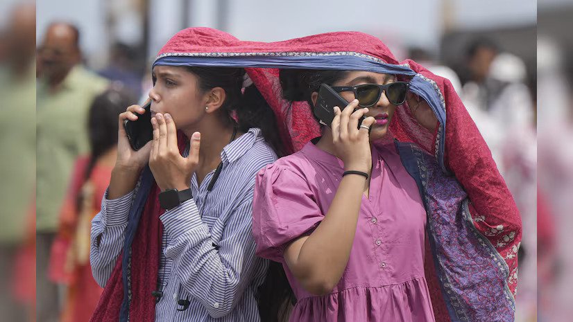
New Delhi: Prevailing Heat wave conditions over Northwest, Central & East India are likely to abate gradually during next 2-3 days. ii. Isolated heavy to very heavy rainfall likely to continue over Northeast India during
next 4-5 days.
Realised weather during past 24 hours till 0830 hours IST of today: (details in Annexure I) ❖ Heat wave to severe heat wave conditions prevailed over many parts of Rajasthan, Punjab, Haryana, Chandigarh-Delhi, Uttar Pradesh; in some parts of Bihar, East Madhya Pradesh; in isolated pockets of Odisha, Jharkhand. Heat wave conditions prevailed in some parts of Himachal Pradesh, Uttarakhand, Vidarbha, West Madhya Pradesh and Chhattisgarh. Heat wave conditions have been prevailing over Haryana, Chandigarh & Delhi, Rajasthan since 17th and over Madhya Pradesh & Uttar Pradesh since 18th
May, 2024.
❖ Warm night conditions observed in isolated pockets of Rajasthan, Uttar Pradesh, Bihar, Jharkhand,
Odisha and Madhya Pradesh.
❖ Yesterday, the highest maximum temperature of 48.3°C was reported at Sri Ganganagar (West
Rajasthan) over the country.
❖ Heavy to very heavy rainfall with extremely heavy falls observed at isolated places over Meghalaya;
Heavy to very heavy rainfall at isolated places over Sub-Himalayan West Bengal & Sikkim, Assam and
heavy rainfall at isolated places over Bihar, Gangetic West Bengal, Kerala and Arunachal Pradesh.
❖ Hailstorm reported at isolated places over Jammu-Kashmir and Uttarakhand.
❖ Gusty winds/squally winds data reported over the country is attached in Annexure II.

Weather Systems and Forecast & Warnings: (Annexure III)
Advance of Southwest Monsoon:
❖ The Southwest Monsoon has advanced into remaining parts of northeast Bay of Bengal and some parts of
northwest Bay of Bengal, remaining parts of Tripura, Meghalaya and Assam and most parts of SubHimalayan West Bengal & Sikkim.
❖ The Northern Limit of Monsoon passes through 13°N/60°E, 12°N/65°E, 11°N/70°E, Amini, Kannur,
Coimbatore, Kanyakumari, 8.5°N/80°E, 13°N/84°E, 16°N/87°E, 18.5N/89°E, 21°N/90°E, 23°N/89.5°E
and Islampur. (Annexure IV)
❖ Conditions are favourable for further advance of Southwest Monsoon into some more parts of central
Arabian Sea, remaining parts of south Arabian Sea, Lakshadweep area and Kerala, some parts of
Karnataka, Some more parts of Tamil Nadu and Southwest Bay of Bengal during next 2-3 days.
2 ❖ A cyclonic circulation lies over northeast Assam & neighbourhood in lower tropospheric levels. Strong
southwesterly/southerly winds are prevailing from Bay of Bengal to northeastern States in lower
tropospheric levels. Under its influence:
✓ Fairly widespread to widespread light to moderate rainfall accompanied with thunderstorm,
lightning & gusty winds (30-40 kmph) likely over Arunachal Pradesh, Assam & Meghalaya,
Nagaland, Manipur, Mizoram & Tripura and Sub-Himalayan West Bengal & Sikkim during next 7
days.
✓ Isolated heavy/very heavy rainfall very likely over Arunachal Pradesh, Assam & Meghalaya, SubHimalayan West Bengal & Sikkim during next 5 days and isolated heavy rainfall over Nagaland,
Manipur, Mizoram & Tripura on 31st May, 2024.
✓ Isolated extremely heavy rainfall also very likely over Meghalaya today, the 31st May, 2024.
❖ A trough runs from north west Uttar Pradesh to west Bangladesh in lower tropospheric levels. Under its
influence:
✓ Isolated to scattered light/moderate rainfall with thunderstorm, lightning & gusty winds (30-
40 kmph) very likely over Bihar, Jharkhand, Gangetic West Bengal, Odisha, Chhattisgarh during
next 5 days and over Madhya Pradesh, Vidarbha, Madhya Maharashtra, Marathwada during 02nd04th June.
✓ Isolated heavy rainfall very likely over Gangetic West Bengal on 31st May & 01st June.
❖ A shear zone runs roughly along Lat. 8°N over south peninsular India and a cyclonic circulation lies over
southeast Arabian Sea off south Kerala in middle tropospheric levels. Strong westerly winds are prevailing
along Kerala Coast. Under its influence:
✓ Fairly widespread to widespread light to moderate rainfall accompanied with thunderstorm,
lightning & gusty winds (30-40 kmph) likely over Kerala & Mahe, Lakshadweep, Andaman &
Nicobar Islands, Karnataka; isolated to scattered light to moderate rainfall over Tamil Nadu,
Puducherry & Karaikal, Coastal Andhra Pradesh, Telangana, Rayalaseema during next 7 days.
✓ Isolated heavy rainfall very likely over Kerala & Mahe, Andaman & Nicobar Islands during 31st
May- 02nd June; Tamil Nadu and South Interior Karnataka on 01st & 02nd June; Coastal Andhra
Pradesh, Telangana, Rayalaseema on 02nd June, 2024.
❖ A Western Disturbance seen as a cyclonic circulation over north Afghanistan & adjoining Pakistan in lower
tropospheric levels with trough aloft in middle tropospheric westerlies roughly along Long. 69°E to the
north of Lat. 32°N. A cyclonic circulation lies over northeast Rajasthan in lower tropospheric levels. Under
its influence;
✓ Isolated to scattered light rainfall accompanied with thunderstorm, lightning very likely over
Jammu-Kashmir-Ladakh-Gilgit-Baltistan-Muzaffarabad, Himachal Pradesh, Uttarakhand during
next 5 days.
3 ✓ Isolated very light/light rainfall with thunderstorm, lightning very likely over plains of Northwest
India during 31st May-03rd June.
✓ Duststorm very likely over East Rajasthan during 31st May-03rd June; Uttar Pradesh on 31st May &
01st and West Rajasthan on 01st & 02nd June.
Maximum temperature observation and forecast for next 5 days:
❖ Areas having maximum temperatures (≥42°C): Yesterday, maximum temperatures were in the range of
45-48°C in many parts of Rajasthan, Haryana-Chandigarh-Delhi; in isolated pockets over Uttar Pradesh, Bihar,
Jharkhand, Odisha, East Madhya Pradesh, Vidarbha; in the range of 42-45°C in many parts of West Madhya
Pradesh, Chhattisgarh, Coastal Andhra Pradesh & Yanam; in isolated pockets over Gujarat, Telangana,
Rayalaseema. These were above normal by 3-6°C over many parts of Northwest India and in isolated parts of
Central & East India.
❖ Gradual fall in maximum temperatures by 2-3°C very likely over Northwest & Central India during next
3 days and no significant change thereafter.
❖ Gradual fall in maximum temperatures by 3-4°C very likely over East India during next 3 days and no
significant change thereafter.
❖ No significant change in maximum temperatures very likely over rest parts of the country.
Heat Wave, Warm Night and Hot & Humid weather warning for next 5 days:
❖ Heat wave to severe heat wave conditions very likely in many parts over Haryana-Chandigarh-Delhi and
heat wave in many parts over Punjab today, 31st May; heat wave in some parts on 01st June and in isolated
pockets on 02nd June, 2024.
❖ Heat wave to severe heat wave conditions very likely in isolated pockets of West Rajasthan, East Uttar
Pradesh, Odisha and Vidarbha on 31st May and isolated heat wave on 01st June.
❖ Heat wave conditions very likely in isolated pockets of Madhya Pradesh, Bihar, Jharkhand, Vidarbha,
Chhattisgarh, Uttarakhand, Coastal Andhra Pradesh & Yanam on 31st May & 01st June; Himachal Pradesh, East
Rajasthan, West Uttar Pradesh on 31st May, 2024.
❖ Warm night conditions in isolated pockets very likely to prevail over Odisha on 31st May & 01st June; Madhya
Pradesh, East Uttar Pradesh on 31st May, 2024.
❖ Hot and humid weather very likely to prevail over isolated pockets of Konkan & Goa during 31st May-02nd
June; Telangana, Rayalaseema on 31st May & 01st June; Odisha on 03rd & 04th June, 2024.


